


Multimedia Gallery
Search results for:
- Media Type: Map
Displaying 11 - 20 of 30

Map
The Azores have long been a popular way station for transatlantic flights.
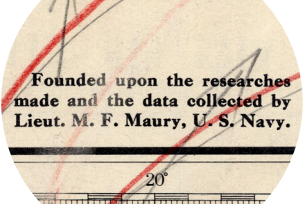
Map
Matthew Fontaine Maury is the father of modern hydrography in the United States Navy.

Map
Elder’s intended course and where she actual ended up were considerably different.

Map
U.S. Navy hydrographers computed an alternate course for Elder and Haldeman after they disappeared.

Map
British and American air navigators used this type of lattice chart with the Gee system over western Europe during World War II.

Map
British and American air navigators used this type of lattice chart with the Gee system over western Europe during World War II.

Map
British and American air navigators used this type of lattice chart with the Gee system over western Europe during World War II.

Map
By the end of World War II, the LORAN system could be used over 30 percent of the globe.
Map
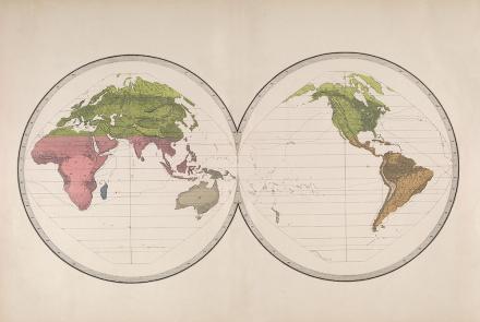
Map of Geographical Distribution of Plants and Animals for the U.S. Exploring Expedition
Map
Map produced by the U.S. Exploring Expedition.