WAAS "Meet the Expert" Educational Event
On September 25, the National Air and Space Museum, in conjunction with the Federal Aviation Administration, is celebrating ten years of service by the Wide Area Augmentation System (WAAS). Other than being a mouthful, what is WAAS? Simply put, it is an enhancement to GPS signals that allows satellite navigation to be used in ways not previously possible.
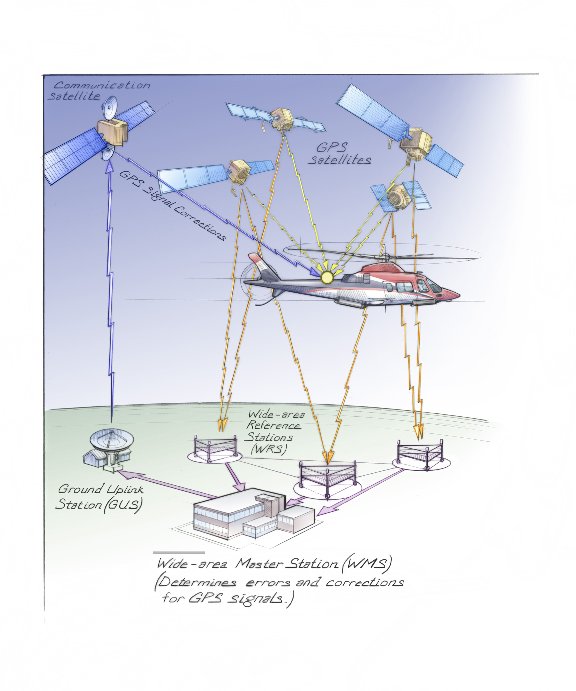
While the orbital configuration of the GPS constellation of satellites is oriented to provide accurate positioning in a horizontal reference system, it is slightly less effective in vertical (altitude) positioning. WAAS overcomes this challenge by using ground stations and satellites to monitor subtle variations in GPS coverage created by variations in the earth magnetic field and other factors. Regional corrections are then broadcast for these minor errors in GPS reception, which improves vertical accuracy to the level that GPS can replace the vertical guidance used in Instrument Landing Systems (ILS). Since the end of World War II, ILS has been the international standard for bringing aircraft to the runway in conditions of poor visibility or low cloud ceilings. The WAAS-based procedures that are an analogue for ILS are known as Localizer Performance with Vertical guidance (LPV).
In addition to having equivalent or better performance than the old ILS procedures, the LPV procedures have an enormous advantage – they require far less local infrastructure and as a result, are less expensive to implement and maintain. ILS was previously reserved for only those airports with high priority commercial or military operations. LPV approaches not only open many more outlying airports to weather limited operations, but also greatly enhance the efficiency of airfields with existing ILS procedures as many more runways can be certified for LPV operations. The ability to reach more remote airfields under conditions of lower cloud ceilings and/or visibility means that air transportation is more reliable, especially for those areas, such as Alaska, which are particularly dependent on air connections. Additionally, non-airport operations such as helicopter air ambulance evacuation or support of offshore oil rigs have the potential to be conducted with far greater safety using LPV.
As of today, 3,323 LPV are now available to appropriately certified aircraft and crews in the United States. This is more than twice the number of ILS procedures available at the peak use of that system. The typical airline passenger will have little awareness that a cockpit revolution is well under way, but rest assured, the way we fly is changing in remarkable new ways.
To celebrate the technical and operational achievements of WAAS, the September 25 event features a historical presentation of traditional radio navigation and approach techniques and allows the visitor to try out a simulated GPS approach procedure. Visitors will also have the opportunity to meet pilots who are enjoying the fruits of this cockpit revolution, including corporate and airline pilots, a helicopter medical evacuation pilot, and engineers who are working to make sure that industries outside of aviation also benefit from the national utility that is WAAS. These include farming, marine navigation and positioning and enhanced surveying and mapping. Come to the Time and Navigation gallery and take the opportunity to find out how the GPS revolution is shaping the world today.