


Multimedia Gallery
Search results for:
- Navigation Methods: Radio Navigation
Displaying 31 - 40 of 103

Map
British and American air navigators used this type of lattice chart with the Gee system over western Europe during World War II.

Artifact
This is the master clock used at the Goldstone, California, Deep Space Network station from about 1983 to 2006.
Illustration
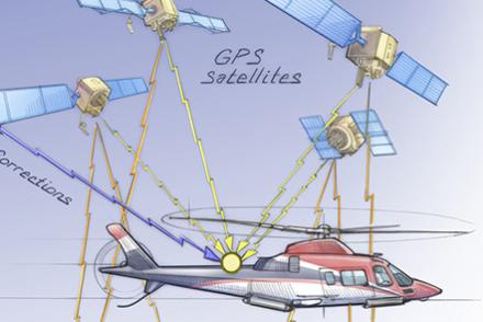
Aircraft equipment interprets time signals received from a network of satellites.

Illustration
This chart taken from an Eighth Air Force report illustrates the relative accuracy of visual bombing methods with radar bombing. As can be seen, radar bombing was far less accurate.
Illustration
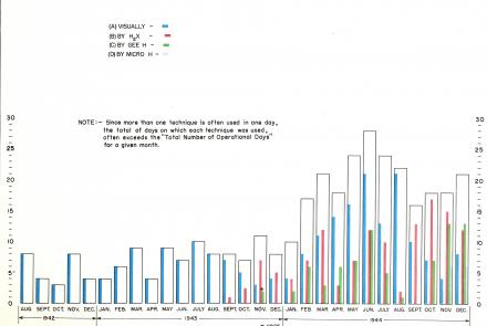
This chart taken from an Eighth Air Force report illustrates the growing dependence on radar bombing methods in the last year of the war in Europe.
Illustration
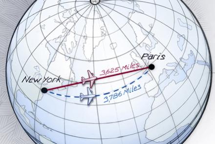
The shortest distance between two points on a globe is not always a straight line—it’s an arc called a great circle.

Illustration
Guidance, navigation, and control are three central facets of managing a craft in space.

Photograph
Lead navigator of the 100th Bomb Group, Eighth Air Force.
Film
Length: 2 Minutes, 17 Seconds
Film
Length: 2 Minutes, 1 Second