Harold Gatty instructs an Air Corps officer in the use of the drift indicator he invented.
Credit: National Air and Space Museum, Smithsonian Institution

Dead Reckoning: An Educated Guess

Knowing position between fixes required its own technology.

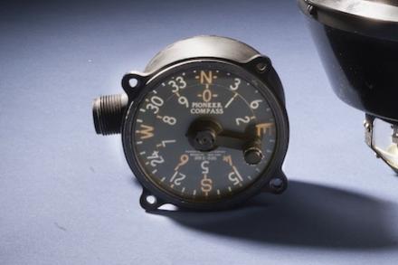
Before the advent of automated positioning systems, such as later versions of LORAN-C, GPS, or the Astroinertial Navigation System that continuously computed positions, aviators and air navigators determined “fixes” by verifying position using known features on the surface, by using computed positions from celestial observations, or by bearings and lines of position from radio navigation stations. Between these fixes, aviators had to depend on a best guess in the form of a calculated position known as dead reckoning. 

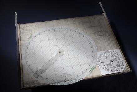
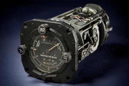
The process of dead reckoning depends on determining wind drift through observations or estimates and predicting the movement of the aircraft based on heading and speed. Over time, this process has gone from manual computation to computer automation, including the implementation of inertial navigation systems in the Cold War that measured acceleration in multiple axes to determine movement over time. 

TOOLS: Radio Direction Finding (RDF) stations, radio compasses, radio range, Very High Frequency Omni Range (VOR), YE-ZB, radar, Gee, Decca, LORAN, GPS.
ADVANTAGE: Works when out of sight of the ground and/or sky.
DISADVANTAGE: Requires complex and heavy equipment in the aircraft and a complex array of ground and/or space-based equipment and infrastructure.
CHALLENGES: Subject to natural or manmade interference. Most prone to technical failure.

The earth inductor compass was popular in the United States for long distance flights in the period 1924-1934. Charles Lindbergh relied on this type of compass on his New York to Paris flight to maintain course until it malfunctioned. It's primary attraction was that it was far more stable than liquid-filled "whiskey" magnetic compasses and featured a controller that could dial in a heading that could be followed with a left/right indicator similiar to that used for VOR navigation decades later. This made is far easier to hold a heading over long periods, particularly when fatigued. It used a wind-driven generator to create an induction field that created variable current as it interacted with the Earth's magnetic field. Less reliable than a liquid compass, it fell out of favor by the mid-1930s, replaced by gyroscopic heading indicators. Albert Hegenberger oversaw its development in the early 1920s for the U.S. Army Air Service.
Lindbergh brought this clock with him on his transatlantic flight in the Spirit of St. Louis. His simple dead reckoning approach to navigation did not require an accurate clock. “Eight-day” refers to how long the clock would run on a full winding. 
Lindbergh carried a Navy drift meter like this one to measure wind drift. He never used it because it was too difficult to mount and operate outside the window while flying and still manage to control the aircraft safely.
Weems and the famous air navigator Harold Gatty worked together to develop this new drift indicator. It could determine drift and ground speed without a cumbersome apparatus deployed outside the aircraft. 
Weems developed this simple but effective plotter for aeronautical charts in 1935. It remains the most popular aviation plotter in the United States. Richard Byrd used this one on his Antarctic expeditions. 
A Gatty-style drift sight was complex, heavy, and less effective for overwater flying. The Pelorus drift sight was smaller and lighter but required more manual calculation and the use of flares or smoke bombs in certain conditions.
The float light was a smoke-producing flare designed to be dropped by an aircraft over open water for drift sighting during the day or night. This type would have been used from the late 1930s through World War II.
The crews of carrier-based aircraft had to keep track of their own position as well as that of their aircraft carrier. This type of plotting board allowed them to track the movements of each and plot a return course.
Most navigators used chart tables for plotting courses. Plotters such as this allowed them to precisely lay out courses and intersecting lines of position.
The B-3 was used on bombers and transports when ground or water could be clearly seen. It evolved from the earlier Gatty drift meters.
One of the navigator’s most essential tools was his set of dividers, used to measure distances on charts.
The Air Position Indicator (API) was a remarkable electromechanical system of dead reckoning. It took inputs from airspeed sensors and gyro magnetic compasses and continuously computed latitude and longitude. This system became standard on the American B-29. The API foreshadowed the future importance of computing in navigation.