


Finding History on eBay
One question I’m often asked as a curator is, “do you ever find anything interesting for the museum on eBay?” The answer is yes. This is the story of a particularly interesting find.
When developing the aviation component of the museum’s “Time and Navigation” exhibit, I wanted to showcase the role of navigational radar in World War II. The use of radar as a navigational aid affected people as no other navigational technology had done previously. The way the radar operator saw the world through his scope had enormous consequences.
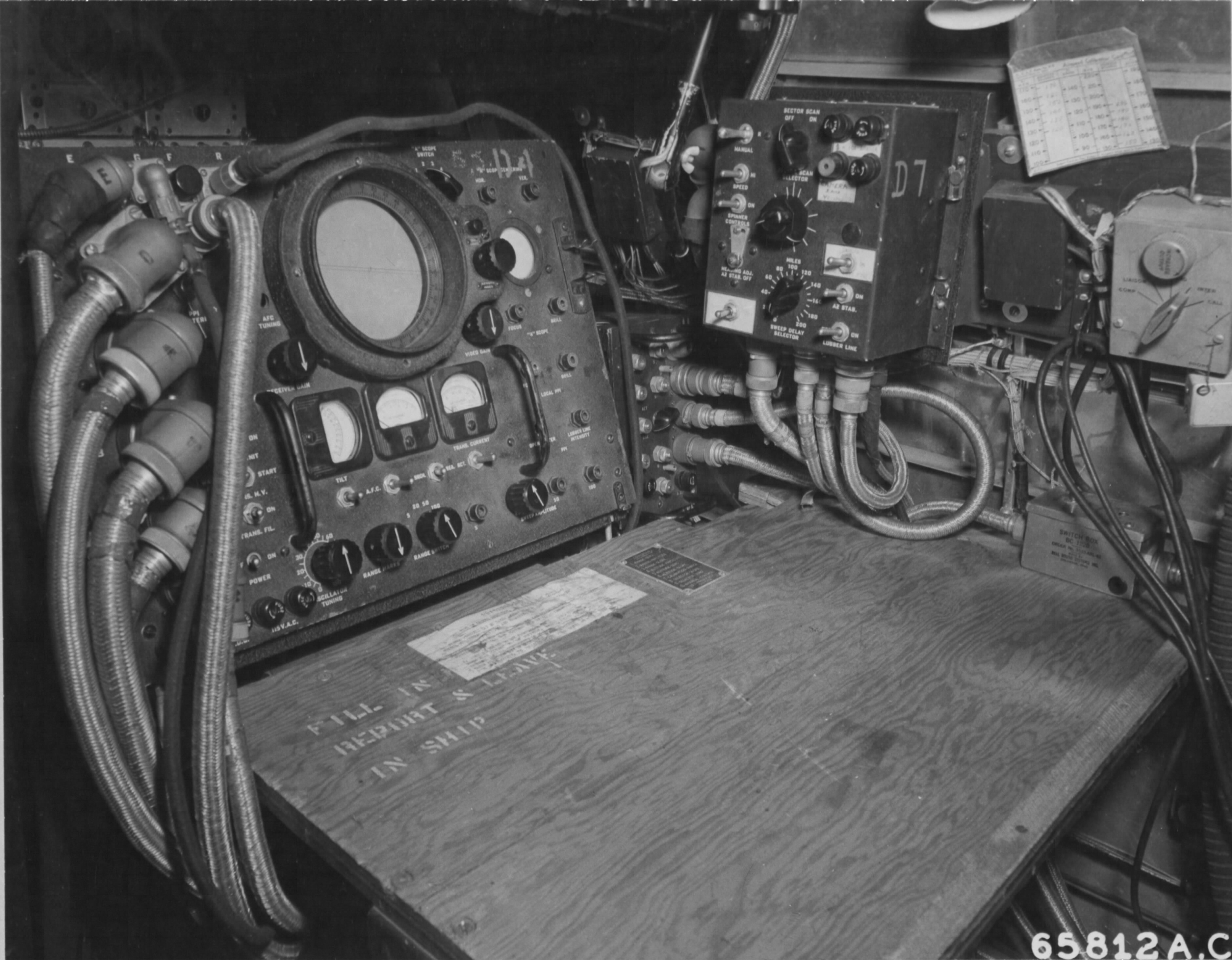
Radar has long been understood as one of the most influential technologies of World War II. Most people are familiar with the use of radar for detecting other airplanes, particularly in the Battle of Britain. Less well known is the critical role played by radar in navigation. Radar was an enormously useful new tool because it could see through clouds and guide airplanes when they were out of range of other radio navigation systems or were subject to jamming. However, radar was complicated, expensive, heavy, and operators required extensive training. This limited the use of radar, particularly in Europe, to specially equipped “pathfinder” aircraft that guided formations of conventional bombers.
Unfortunately, these systems had one great weakness. The wavelength of radar signals used by the allies for the latter part of the war did not provide a high degree of definition for terrain detection. For the most part, only two things stood out for the operator (or “Mickey” as he was usually nicknamed for reasons that are not entirely clear now) – shorelines and the vertical surfaces of buildings in cityscapes. This required special maps so that radar operators could focus on interpreting only what they could see on their scope. It also meant that in poor weather, commanders usually directed bombing raids toward cities, because those were the only targets that could be pinpointed with any degree of accuracy. One reason that cities in Germany were bombed so heavily in the last year of the war was the combination of especially poor weather and the rapidly growing reliance on radar to guide operations. The use of pathfinder aircraft exacerbated the situation because the non-radar equipped formation dropped their bombs in conjunction with the pathfinder rather than selecting a visual aim point. This further increased the inaccuracy of the bombing and was impractical for smaller targets.
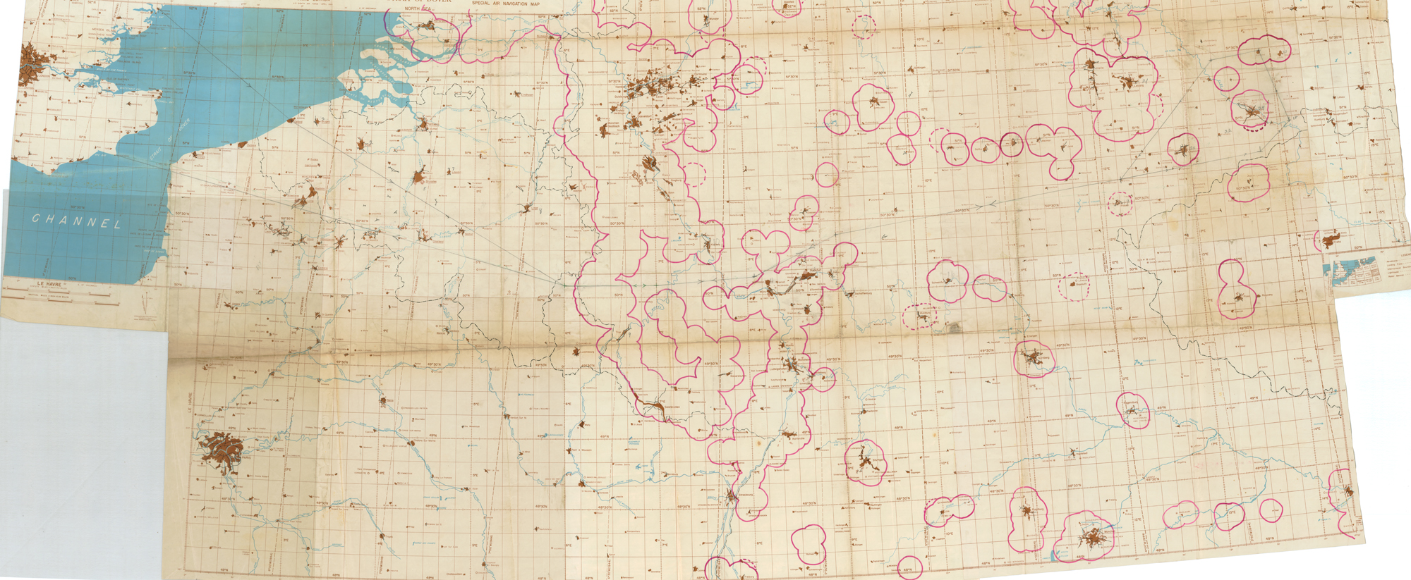
I wanted to demonstrate this link between the limitations of the radar scope, the sparse depictions of radar charts, and changes in target selection by displaying a period radar navigation chart alongside the period radar scope we were exhibiting. Surprisingly, the National Air and Space Museum’s normally abundant archives lacked examples of this significant type of charting. While the National Archives does hold examples, getting them duplicated was daunting from a cost standpoint, so I elected to see what I could find on eBay.
As luck would have it, within a week I had located a poorly described listing that appeared to be a period WWII radar chart. The description merely described it as an “aeronautical chart” and featured one photo of the map completely folded with a small part of southeast England and the English Channel visible – not incredibly promising given that I was looking for something that would depict operations over occupied Europe. Unfortunately, it was all I could find, so I put a bid in. I was the sole bidder and acquired it for all of $25. When I finally received it in the mail, I realized how incredibly lucky I had been. The chart was far larger than the description or photo indicated, covering most of northwest Europe from western England to eastern Germany. It consisted of several radar charts taped together for a specific mission, presumably by the bomb group’s intelligence section that had also hand-inked the German flak belts on the map. Most notably, it had a mission route hand drawn on it in pencil stretching across the approximately seven-foot width of the chart, making it very likely that it that it was used on an operational mission.
From the pencil route and position of the marked flak belts, I figured it would be a fairly easy matter to determine the specific mission. The target designated on the map was an industrial town in eastern Germany – Ruhland. The oil refineries there were a frequent target for the B-17s of the Eighth and Fifteenth Air Forces. After researching the movement of the frontlines in the two months after the Battle of the Bulge relative to the inked-on flak defenses and knowing the dates of missions to Ruhland, I could pinpoint the map to a particular bombing raid – one that had enormous significance beyond its place in history as a military operation.
The Eighth Air Forces’ Mission 832 on February 15, 1945 was to strike the refineries at Ruhland, Böhlen and Madgeburg with 1,131 heavy bombers. The oil plants did not stand out enough on the H2X radar used by the B-17 pathfinders, so when the bombers on the Ruhland and Bohlen target runs found their aim points obscured by clouds, they diverted to their secondary radar target of opportunity – the railroad marshaling yards of Dresden.
Bomber crews knew that with the limited accuracy of bombing under radar (only 50% of bombs would land within a mile of the target), aiming at an urban rail yard on radar meant simply targeting the city itself. Generally, up to this time, American commanders had avoided listing cities as targets in their own right, and instead focused on picking specific military or industrial targets as aim points. In reality, the inaccuracy of radar (as well as visual bombing) was such that striking targets in or adjacent to cities was operationally no different than the heavy bombing raids of the British Royal Air Force (RAF), whose night missions focused principally urban areas. RAF leadership was more willing to target cities as part of a strategic doctrine of undermining enemy morale, but the operational reality was that cities were the only target that could be reliably struck at night when bombers were less vulnerable to fighters and flak.
Dresden was no different than dozens of other German cities in terms of being targeted in this manner. However, Dresden stands out in history as being a particularly devastating example of area bombing, not because it was fire-bombed with incendiaries, or because of the tonnage of bombs dropped, or even because of Kurt Vonnegut’s visceral accounts of the effects in his Slaughterhouse Five. Rather, because of the reliance on radar bombing and poor weather on February 15th, an unusually high number of bombers diverted to Dresden creating a nearly continuous chain of British and American bombing raids on the city over thirty-six hours in duration. In most other German cities that had been bombed, raids lasted several hours at most. Even when firestorms occurred there was often some respite to fight fires, flee, or dig out from the rubble. Dresden was already suffering under an unusual confluence of intensive RAF raids on the nights of February 13th and 14th and American Army Air Forces raids during the day on the 14th.
When the redirected raids from Ruhland and other targets appeared over Dresden on the 15th, the recovery was thrown into chaos. It was the unremitting nature of the raids that made Dresden a unique horror for the residents of the city. Though casualties ran into the tens of thousands, the Dresden bombing has not been debated principally because of its high casualty count or damage to historic districts. Rather, the sustained intensity caused post-war controversy about the morality of urban area bombing. By the end of the war, new radar systems, such as the AN/APQ-7 Eagle, had sufficient resolution to ensure that the haphazard assigning of cities as radar secondary targets could be avoided in the future.
Of all of the charts I could possibly have located for the exhibit, I couldn’t have conceived of a better one for illustrating just how much navigational methods can affect human life. The lesson for historians is that there is value in locating “material culture” (what anthropologists call the physical things people use in the course of their activities) in places like eBay and looking beyond conventional archives. For those simply looking to collect interesting things, the lesson is that if you “know your subject,” you can find some truly remarkable artifacts that would otherwise be overlooked.


1 Comments
This entry and the accompanying maps is particularly interesting to me as I have recently been doing research into H2X. I manage a small independent museum in London, Ontario, called The Secrets of Radar Museum, and we just received a complete H2X. Finding that map on eBay is incredibly lucky. Thankfully, SoRM was founded by at least a few RCAF vets with sticky fingers and we have a couple really special maps in our collection, but no large scale radar chart like that. Thank you for sharing !