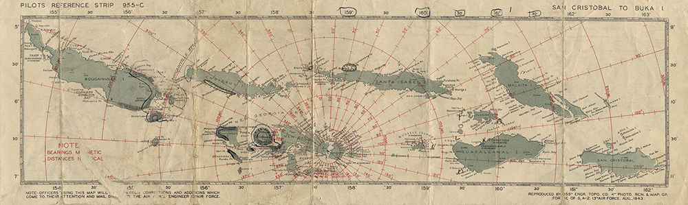
Chart, Pilots Reference Strip 955-C, San Cristobal to Buka Island, 1943
Lt. Reinhardt Leu used this chart in 1943 while flying Vought F4U Corsairs with squadron VMF-215, based on Espiritu Santo and then Bougainville. Leu and his fellow pilots had to navigate long distances over water in single-engine airplanes, with little hope of rescue if they had to bail out.
Caption:
Charts like this were used by Navy pilots throughout the Pacific.
Type: Map
Image Date: 1943
Credit: National Air and Space Museum, Smithsonian Institution
Origin: 955th Topographic Company, 4th Reconnaisance and Map Group, 13th Air Force, U.S. Army