Multimedia Gallery
- Media Type: Illustration
This image shows the landing area chosen for the Mars Science Laboratory rover Curiosity.
Navigators used radio signals to guide rovers to Mars. This is the target area for the rover Opportunity, which landed on Mars in 2004.
Lines of latitude are imaginary lines circling the globe parallel to the equator. The lines are designated in degrees north or south of the equator, from 0° at the equator to 90° at the poles.
In 1837, Captain Thomas Sumner of Boston devised what would become "line of position" sailing.
Lizards, South America (Teius teguixin, Brachylophus fasciatus, Hoplodactylus pomarii)
Lines of longitude are imaginary lines circling the globe through poles. Also called meridians, they are designated in degrees east of west of a starting reference line from 0° at the prime meridian to 180° on the opposite side of the globe.
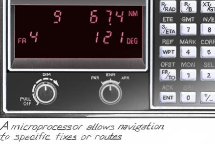
Aircraft equipment interprets time delays from pairs of ground stations.
Lyre crab, Northwest coast (Maoidea, Hyas Lyratus, Chorilla Longpipes)
Marine chronometers are precise, specialized clocks for finding longitude at sea. They serve as portable time standards.
Launched in 1973, Mariner 10 used the gravity of Venus to propel it to Mercury with a minimal use of fuel.


