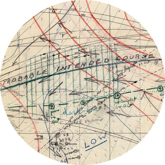
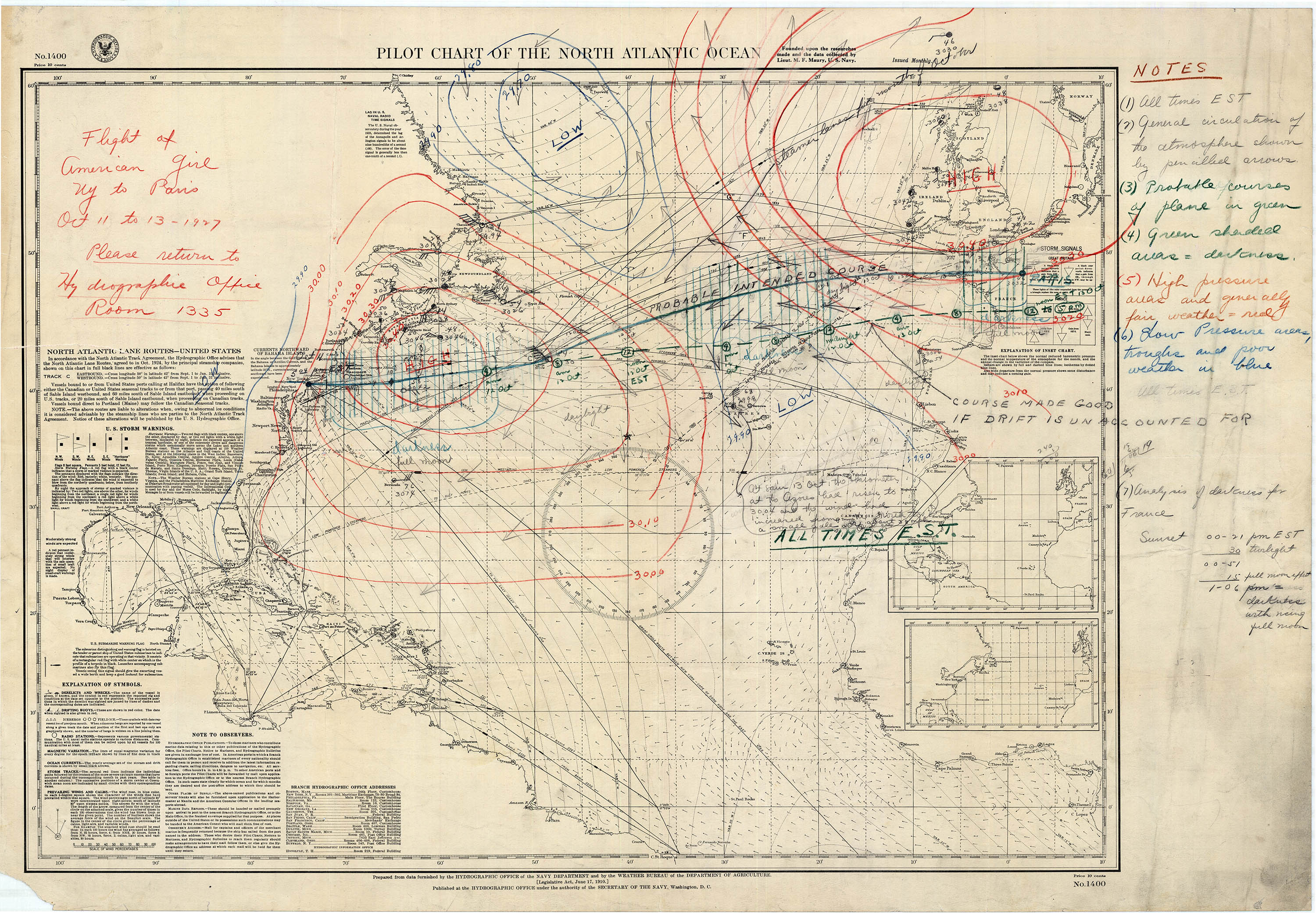
Elder’s intended course and where she actual ended up were considerably different. The search and rescue chart prepared upon Elder and Haldeman's disappearance depicts a considerable amount of key data, including, probable intended course, likely actual course if drift was not corrected, weather systems, wind and ocean currents, zones of day and night, along with suspected positions at four hour intervals. Elder and Haldeman's actual track appears remarkable close to this estimate. The times appear to be Eastern Standard Time. "The American Girl" appears to have been significantly behind schedule. The airplane was in the air for thirty-six hours - nearly three hours longer than Lindbergh had been, but had not made two-thirds of the distance. It is not known what the next step for this chart would have been had Elder and Haldeman not been reported safe. Likely, the chart would have been used to coordinate a search by naval and commercial shipping in the area. Similar searches in this era were almost always fruitless.
Caption:
Elder’s intended course and where she actual ended up were considerably different.
Type: Map
Credit: National Air and Space Museum, Smithsonian Institution.
Aviator Ruth Elder and her co-pilot/instructor George Haldeman disappeared over the Atlantic creating a desperate scramble to determine their whereabouts.