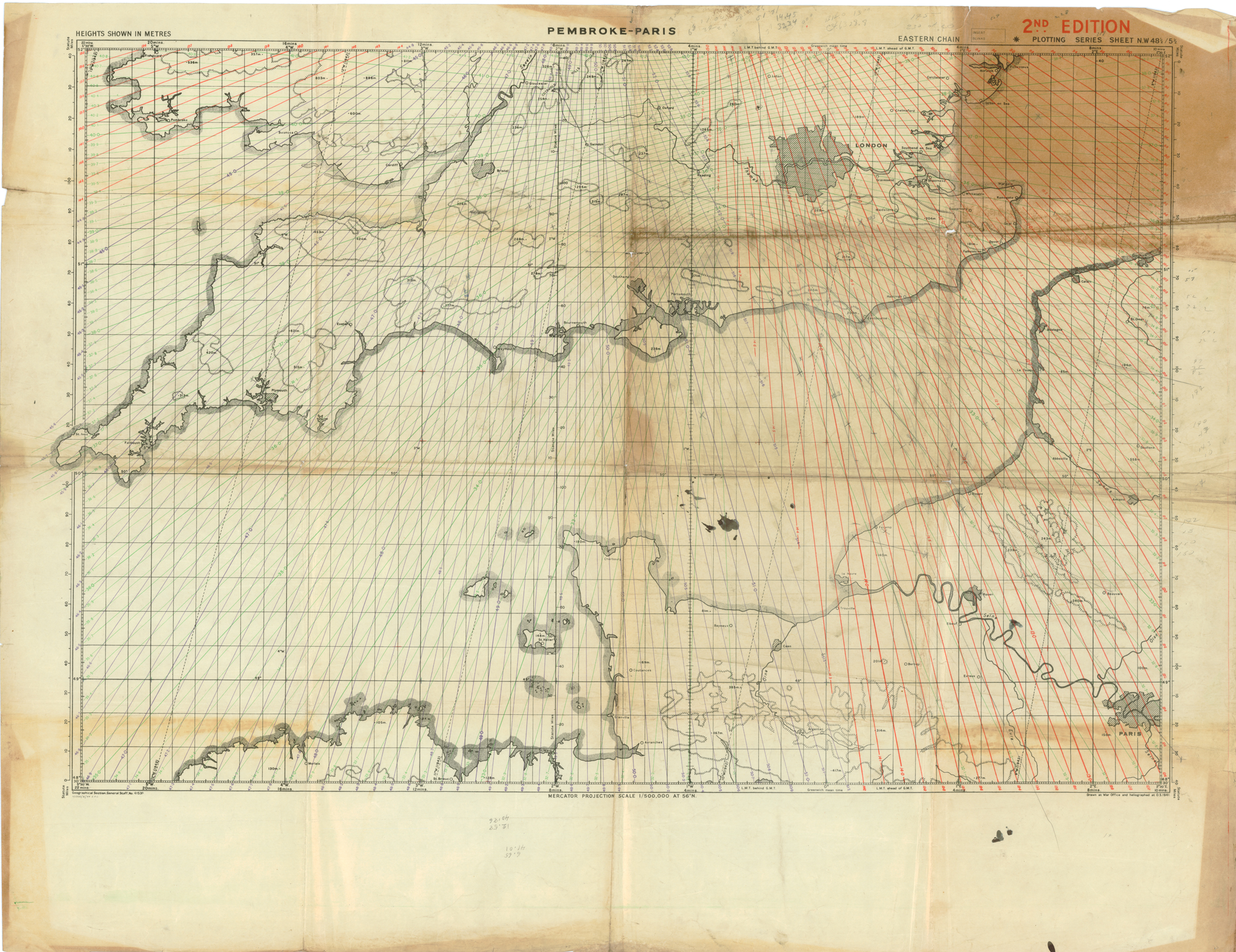
This Gee lattice chart covers southern England, the English Channel, and the Normandy area of operations. Pencil marks on the bottom edge indicate that this chart was likely used in training and in operations over the beachhead. Aircrews carried these charts to determine lines of position using a Gee receiver and oscilloscope. The Royal Air Force (RAF) established new chains as the Allies advanced eastward after D-Day. An operator using this chart could determine a fix using two or three lines of position within three or four minutes.Gee was a hyperbolic system that provided short range navigation and bombing guidance over Britain, western Europe and the northern Mediterranean during World War II. Developed by the British Telecommunications Research Establishment (TRE) under the technical guidance of Robert G. Dippy, the system guided ships and larger aircraft (bombers, transports, reconnaissance aircraft, and night fighters) to accuracies of a statute mile or better at ranges up to four hundred statute miles. Both the Royal Air Force Bomber Command and American VIII Bomber Command depended extensively on the technology. A blind bombing system called Gee-H (or GH) used the Gee transmitters along with modified aircraft equipment to create a transponder system that could guide bombers at night or in cloud to within several hundred yards of a target.
Caption:
British and American air navigators used this type of lattice chart with the Gee system over western Europe during World War II.
Type: Map
Image Date: 1944
Credit: National Air and Space Museum, Smithsonian Institution.