


Multimedia Gallery
- Search Terms: Satellite

A professor and aeronautical engineer at MIT, Charles Stark Draper played a major role in advancing the art of inertial navigation.
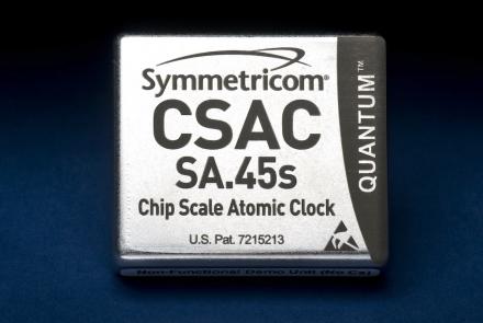
This represents the first commercially available chip-size atomic clock.
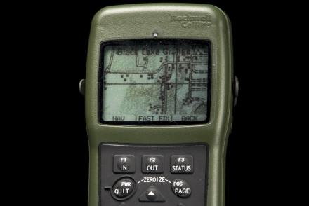
The DAGR was an improvement on the PLGR, providing map data in a lighter hand-held device.

Firefighter John F. Sullivan explains, “When firefighters enter a burning structure, especially large complex commercial buildings, they can quickly lose visibility and their ability to maintain orientation. And traditional GPS doesn’t work inside buildings.”
Transit was the first satellite-based global positioning and navigation system.
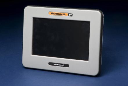
Roy Bardole used this touch-screen computer and an antenna (not shown) to receive enhanced GPS signals for working corn and soybean acreage in Iowa.

This equipment made up a prototype emergency location service based on GPS positioning.

SECOR, a satellite used as part of a U.S. Army experimental navigation system.

Engineers on the night of the launch at the Jet Propulsion Laboratory in Pasadena, California, where Pioneer 4 was built.

Engineers at Goldstone prepare for the launch of Pioneer 4.