In four years, the expedition effectively remapped the Pacific Ocean.
Wilkes and his crew made the most of the accuracy of their navigational instruments. Their observations resulted in some of the most accurate charts and maps of the time. The United States used these invaluable charts and maps as late as the Pacific campaign during World War II.
Antarctica
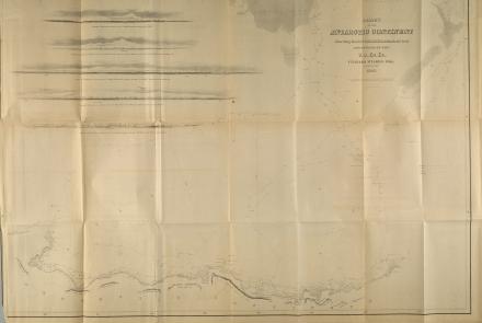
The existence of an Antarctic continent had long been rumored but remained unconfirmed. During the 1760s, Captain James Cook reached the Antarctic Circle but found only icebergs. Credit for substantiating Antarctica is divided. Two expedition members, William Reynolds and Henry Eld, sighted land the same day as French explorer Jules Dumont d‘Urville. Wilkes surveyed 2,400 kilometers (1,500 miles) of Antarctic coastline, an area still known as “Wilkes Land.”
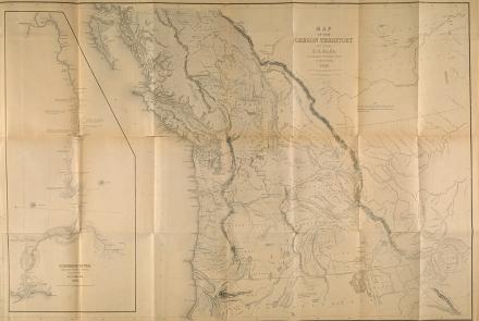
The Columbia River and The Northwest Coast
Despite losing one of the largest ships along Oregon’s treacherous coastline, the expedition completed the first American survey of the Columbia River and charted areas along the Northwest coast never before explored by Americans or Europeans.
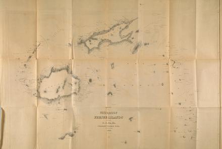
Fiji and the South Pacific
The shoals of the South Pacific, especially around Fiji, were highly valuable to whalers but extremely dangerous to ships due to their shallow depths and jagged reefs. Accurate charts of the South Seas were incomplete. Shipwrecks were common. For the American whaling industry, mapping this area was the expedition’s most useful achievement.