


Multimedia Gallery
- Search Terms: Charts
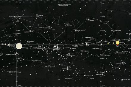
This Star Chart was used to train Apollo astronauts.
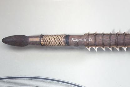
This sword made from shark teeth was collected by the U.S. Exploring Expedition in the Gilbert Islands.
While returning from a “shuttle” mission to the Soviet Union on July 5, 1944, the 100th Bomb Group attacked targets in France. Crosby used this map during the mission.

Josiah Perkins Creesy, Jr. commanded the ship, and, uncommon for the time, his wife Eleanor navigated. As a child in Massachusetts, she had learned navigation skills from her seafaring father.

This map depicts their route and includes eyewitness accounts from crew members who had to navigate through unfamiliar seas and lands.

The Nautical Almanac, first published in 1766

The U.S. Exploring Expedition included a formidable group of botanists, naturalists, artists, taxidermists, and other scientists.
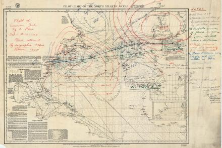
Aviator Ruth Elder and her co-pilot/instructor George Haldeman disappeared over the Atlantic creating a desperate scramble to determine their whereabouts.
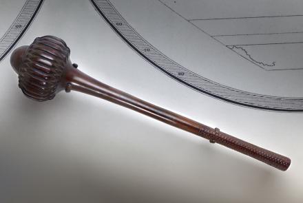
This war club was collected by the U.S. Exploring Expedition in Fiji.
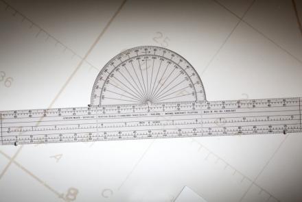
Weems developed this simple but effective plotter for aeronautical charts in 1935.