


Multimedia Gallery

The TIMATION 1 satellite, NRL’s first experiment in using time signals for navigation.

An artist’s rendering of Timation 3 navigation satellite orbiting in space.

Magazine cover depicting the attack on Korean Airlines flight 007.
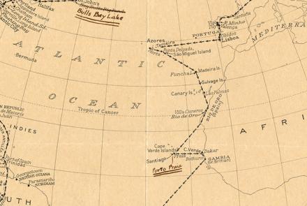
Route map created by Charles and Anne Morrow Lindbergh after their flight in the Tingmissartoq.

The U.S. Exploring Expedition included a formidable group of botanists, naturalists, artists, taxidermists, and other scientists.

This device received navigation signals transmitted by Transit satellites passing overhead.

Transit land navigation system installed in a vehicle.
A backup Transit 5-A satellite from the 1970s.
The Doppler shift of signals from a moving satellite is used to determine the satellite's orbit compared to the location of the tracking station.
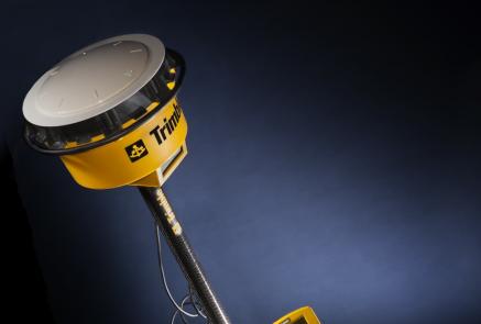
The Trimble 4800 GPS Receiver was used by professional surveyors.