Submarines used radio signals to correct their inertial navigation systems.
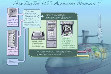
Submarines carry an inertial navigation system, which measures the boat’s motion and constantly updates position. Because it does not rely on radio signals or celestial sightings, it allows the boat to navigate while remaining hidden under the surface. To maintain accuracy, the submarine must periodically update its position using outside navigational radio signals. From the 1960s to the 1990s, Transit satellites and LORAN shore stations provided those signals. GPS has now replaced both.
Navigating the USS Alabama
The Alabama was built with three navigation systems: the ship’s inertial navigation system (SINS), a Loran-C receiver, and a Transit satellite receiver system for correcting the inertial system. It has since been fitted with a GPS receiver and the Trident II navigation system.
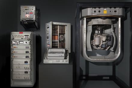
Ship’s Inertial Navigation System (SINS) Stable Platform and Housing Assembly
The Alabama has three inertial guidance units. Manufactured by the Autonetics Marine Systems Division of Rockwell International (now Boeing), the SINS was installed on the boat in 1983 and removed in 2006 after over 60 patrols.
Information about the ship’s position, speed, heading, and attitude were constantly transmitted from the SINS to the missile fire-control system. The boat’s exact position was required for launching ballistic missiles.


