Smithsonian
  • Navigating
    at Sea
    • Challenges of Sea Navigation
    • Navigating Without a Clock
    • The Longitude Problem
    • The U.S. Goes to Sea
    • Navigate at Sea! Activity
  • Navigating
    in the Air
    • Challenges of Air Navigation
    • Early Air Navigators
    • Navigation at War
    • Navigate the Skies! Activity
  • Navigating
    in Space
    • Challenges of Space Navigation
    • Reaching for the Moon
    • Navigating in Deep Space
    • Navigate in Space! Activity
  • Satellite Navigation
    • Challenges of Satellite Navigation
    • Reliable Global Navigation
    • Global Positioning System (GPS)
    • Who Uses Satellite Navigation
  • Navigation
    for Everyone
    • Meet a Professional Navigator
    • Personal Navigation Stories
  • Timeline of Innovation
  • Artifacts
  • Learning Resources
  • Multimedia Gallery
  • Research
  • Visit the Exhibition

Search form

Time and Navigation Home
Facebook Twitter YouTube Pinterest
Time and Navigation
The untold story of getting from here to there.
Home

Search form

  • Navigating at Sea
  • Navigating in the Air
  • Navigating in Space
  • Satellite Navigation
  • Navigation for Everyone
  • Timeline of Innovation
  • Artifacts
  • Learning Resources
  • Multimedia Gallery
  • Research Journal
  • Visit the Exhibition
  • Challenges of Air Navigation
    • Flying Boats Cross the Seas
    • Overcoming the Challenges
      • Celestial Navigation
      • Radio Navigation
      • Dead Reckoning
    • Navigate the Skies! Activity
  • Early Air Navigators
    • Dying to Set Records
    • Charles Lindbergh's Calculated Risk
    • The Business of Air Navigation
      • The Teacher: P. V. H. Weems
      • The Air Navigation Community
      • Radio Time for Aviation
    • Lindbergh's New Tools
    • Two Men in a Hurry
      • The Winnie Mae
      • Meet the Navigator: Harold Gatty
    • Navigation Gone Wrong: Amelia Earhart
  • Navigation at War
    • The Wartime Navigator
      • Harry Crosby
      • Tools of the Trade
    • Naval Aviation
      • Meet the Navigators: WAVES
    • A New Era in Time and Navigation
      • Hyperbolic Systems
      • LORAN
      • Meet the Clockmaker: Alfred Loomis
  • Navigate the Skies! Activity

Did You Know?

P. V. H. Weems sent a letter to Earhart offering to train her as he had famed British aviator Amy Johnson.
Learn More »

Explore More

RCA AVR-15A Radio Range Receiver »
Mary Tornich »
Longines Weems Second Setting and Lindbergh Hour Angle Watch Advertisement »
Wiley Post and Will Rogers »
"Flying the Beam" »
Navigation Gone Wrong

Amelia Earhart

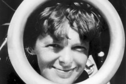
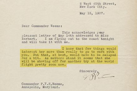
During an around-the-world flight attempt in 1937, Amelia Earhart and her expert navigator, Fred Noonan, vanished in the South Pacific.

What Happened

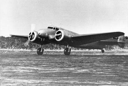
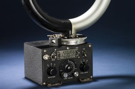
The Lockheed Model 10E’s limited range forced them to use tiny and remote Howland Island as a refueling stop. Missing it would guarantee disaster. They overflew the Gilbert Islands, their best means of fixing position, in the dark. Their eastbound route led them into headwinds that cost them fuel. Clouds hampered their navigational sightings. Neither knew Morse code, critical for the ship-based radio direction finder system the Navy used to support their flight. The plane was poorly outfitted for navigation and long-range communication, and neither was well trained on the radio equipment they did have.

“[Fred] Noonan is the only one of Commander Weems’ students who has ever been lost at sea.” —“Baltimore Sun,” 1937

The Consequences

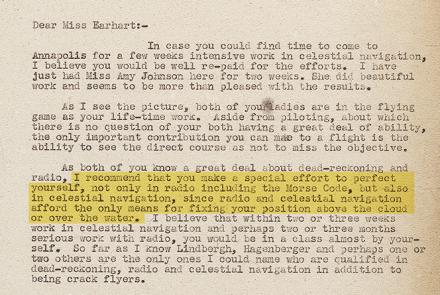
Their flight required an effective blend of dead-reckoning, celestial navigation, and radio direction finding, but poor planning, inexperience, and circumstance compromised all three. They never reached Howland Island and likely perished in the ocean.

Lessons Learned

The exact errors that caused Earhart and Noonan to miss Howland Island may never be known, but their disappearance served as warning to other aviators not to take navigation lightly.

b11f2i9.jpg

Fred Noonan and Amelia Earhart
They vanished in the South Pacific on June 2, 1937.
Credit: Purdue University Archives

si-71-1055qm.jpg

Amelia Earhart Holding Bendix Radio Direction Finder Loop Antenna
Earhart's lack of familiarity with the Bendix radio direction finder was a significant liability.
Credit: National Air and Space Museum, Smithsonian Institution

si-71-1060p.jpg

Lockheed Model 10E Electra
The 10E was an excellent aircraft, but it lacked sufficient range to make a South Pacific crossing safe and practical.
Credit: National Air and Space Museum, Smithsonian Institution

nasm2012-02106.jpg

Bendix Radio Direction Finder
Earhart used an antenna similar to this later model in her attempt to locate Howland Island.
Credit: National Air and Space Museum, Smithsonian Institution

337-earhart_lt_300ppi.jpg

Letter from P. V. H. Weems to Amelia Earhart Offering Navigational Instruction
Weems had just trained famed British aviator Amy Johnson in celestial navigation.
Credit: National Museum of American History, Smithsonian Institution

337-putnam_ltr_300ppi.jpg

Letter from G. P. Putnam to Weems Declining Navigation Instruction on Behalf of His Wife, Amelia Earhart
Amelia Earhart was busy in May 1937 repairing her crash-damaged Lockeed Electra 10E.
Credit: National Museum of American History, Smithsonian Institution

a_tragedy_of_the_pacific_-_1937_earhart_disappearance_-_pathe_927.14.mp4

"A Tragedy in the Pacific" [Run Time [1:23]
Amelia Earhart Goes Missing
Credit: WPA Film Library
previous pauseresume next
  • Navigating at Sea
    • Challenges of Sea Navigation
    • Navigating Without a Clock
    • The Longitude Problem
    • The U.S. Goes to Sea
    • Navigate at Sea! Activity
  • Navigating in the Air
    • Challenges of Air Navigation
    • Early Air Navigators
      • Dying to Set Records
      • Charles Lindbergh's Calculated Risk
      • The Business of Air Navigation
      • Lindbergh's New Tools
      • Two Men in a Hurry
      • Navigation Gone Wrong: Amelia Earhart
    • Navigation at War
    • Navigate the Skies! Activity
  • Navigating in Space
    • Challenges of Space Navigation
    • Reaching for the Moon
    • Navigating in Deep Space
    • Navigate in Space! Activity
  • Satellite Navigation
    • Challenges of Satellite Navigation
    • Reliable Global Navigation
    • Global Positioning System (GPS)
    • Who Uses Satellite Navigation
  • Navigation for Everyone
    • Meet a Professional Navigator
    • Personal Navigation Stories
  • Timeline of Innovation
  • Artifacts
  • Learning Resources
  • Multimedia Gallery
  • Research
  • Visit the Exhibition
  • Terms of Use
  • Privacy
  • Contact
  • Sponsors
  • Press
  • Donate
Smithsonian Logo National Air and Space Museum Home National Air and Space Museum Home National Museum of American History Home
Smithsonian
Home Facebook Twitter Google Plus Pinterest YouTube

This exhibition is a collaboration between the National Air and Space Museum and the National Museum of American History.

Sponsors | Contact | Terms of Use | Privacy